Research Projects
The Rempe research group focuses on hydrologic processes in the shallow subsurface and their influence on ecology and landscape evolution at a variety of time scales. Below is information about some ongoing projects.
Widespread use of bedrock water (and rock moisture, in particular) across the U.S.
Check out our most recent paper (accepted at Nature, 2021) where we use a combination of field and remotely sensed data to estimate the extent and frequency of bedrock water use by woody plants across the continental U.S. We find that forests commonly exist on shallow soils underlain by bedrock and that bedrock water, in the form of rock moisture and groundwater, is likely a critical source for transpiration for many ecosystems.
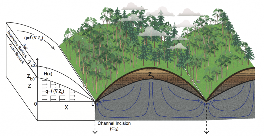
Controls on the Bottom Boundary of the Critical Zone
As the Earth’s surface evolves, the development of a weathering front into underlying fresh rock strongly influences soil generation, the availability of water to ecosystems and the atmosphere, erosional processes, and even global climate via silicate and carbonate weathering fluxes. Yet, despite its importance in defining the bottom boundary of the hydrologically dynamic Critical Zone, little is known about what controls the evolution of the weathering front under actively eroding landscapes. Our group is investigating mechanisms for feedbacks between the evolution of the Earth's surface and subsurface weathering fronts.
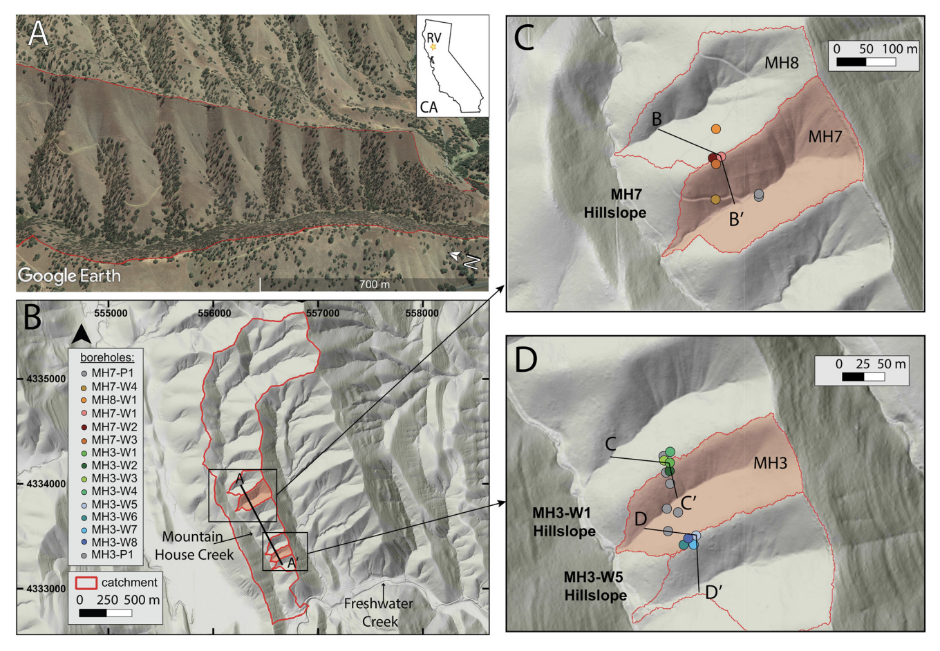
Topography and Bedrock Weathering
Bedrock weathering regulates nutrient mobilization, water storage, and soil production. Deep drilling, downhole logging, and characterization of chemistry and porosity reveal two weathering fronts across a sequence of three ridges and valleys in the sedimentary Great Valley Sequence in Northern California that share a tectonic and climate history. These findings provide evidence for feedbacks between erosion and weathering in mountainous landscapes that result in systematic subsurface structuring and water routing.
Carbon Dioxide Production in Bedrock Beneath Soils Substantially Contributes to Forest Carbon Cycling
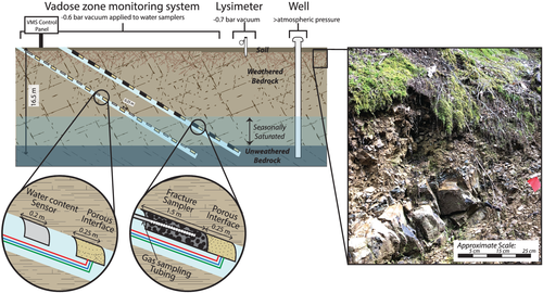
Here we use innovative monitoring technology, the vadose-zone monitoring system (VMS), to sample gases in fractured bedrock and show that there is substantial production of CO2 in weathered bedrock at 4–8 m below the thin soils of a Northern California forest. This deep CO2 production supports a persistent upward flux of CO2 year-round from bedrock to soil and constitutes between 2% and 29% of the average daily CO2 efflux from the land surface. When water is rapidly transported across the fractured bedrock vadose zone, nearly 50% of the CO2 produced in the bedrock dissolves into water, promoting water-rock interaction and export of dissolved inorganic carbon (DIC) from the unsaturated zone to groundwater. This can constitute as much as 80% of the DIC exiting the hillslope. Such CO2 production in weathered bedrock is subject to unique moisture, temperature, biological, and mineralogical conditions which are currently missing from terrestrial carbon models.
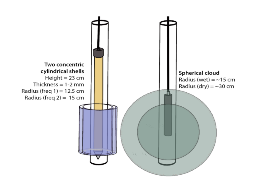
Measuring rock moisture dynamics in-situ with NMR
We use borehole nuclear magnetic resonance (NMR) at two sites in seasonally dry California to quantify dynamic rock moisture storage. We show strong agreement between NMR estimates of dynamic storage and estimates derived from neutron logging and mass balance techniques. The depths of dynamic storage are up to 9 m and likely reflect the depth extent of root water uptake. To our knowledge, these data are the first to quantify the volume and depths of dynamic water storage in the bedrock vadose zone via borehole NMR.
Transport of Water and Solutes through Fractured Rock
The chemical composition of stream water reflects the pathways through which water traveled through a landscape and contributes to our understanding of the physical, chemical, and biological processes that alter rock in the subsurface. Samples of soil moisture and groundwater provide us with part of the picture, but in uplands environments where much of the runoff occurs through weathered and fractured rock, we lack direct observations of water fluxes and chemistry in the unsaturated zone. In a heavily instrument hillslope in Northern California, we installed sensors and samplers in an inclined borehole within fractured, weathered rock to document the evolution of water through the unsaturated zone.
Geophysical Imaging of Landscape Scale Patterns of Weathering
In an ongoing collaboration with the Wyoming Center for Environmental Hydrology and Geophysics and the Eel River Critical Zone Observatory, we are measuring the structure of the weathered zone within hillslopes using near-surface geophysical tools. We seek to document spatial patterns of rock properties in diverse lithologies, climates, and tectonic histories to understand the mechanisms that lead to systematic patterns of weathering across landscapes. We rely primarily on electrical resistivity and seismic velocity to understand how fluids and pore space are distributed within the subsurface. These field scale geophysical data along with samples and monitoring data from boreholes are used to link the observed rock properties to the suite of weathering processes from which the properties were derived.